Why Geotagging Water Quality Data Matters
Geotagging Water Quality Data: Strengthening Global Water Monitoring Through Location Intelligence
As the world faces mounting water challenges, the need for accurate, transparent, and verifiable environmental data has never been greater. From agricultural runoff to industrial discharge, understanding not just what is in our water but where it originates is essential. That’s why geotagging water quality data is emerging as one of the most transformative tools in modern water management.
By linking every sample or test result to its exact geographic coordinates, geotagging adds a crucial layer of spatial intelligence to environmental monitoring. It enables researchers, regulators, and communities to pinpoint pollution hotspots, track contamination pathways, and plan interventions with precision. Supported by advanced field instruments and mobile data capture, geotagging is helping bridge the gap between on-the-ground testing and big-picture decision-making.
Why Geotagging Water Quality Data Matters
Traditional water testing provides vital chemical and physical information, but without location data, its usefulness can be limited. Inconsistent or poorly recorded sampling points make it difficult to compare results, track trends, or identify pollution sources. By integrating GPS technology into testing workflows, every data point gains context, traceability, and accountability.
When applied systematically, geotagging water quality data delivers three key benefits:
- Traceability: Each reading is automatically time-stamped and geo-referenced, allowing regulators and scientists to verify exactly where it was collected.
- Spatial analysis: Geotagged datasets enable mapping of pollution patterns, identifying areas at highest risk of contamination.
- Data integrity: Linking results to precise coordinates reduces human error, ensuring that repeat sampling and longitudinal studies are accurate.
This approach is proving particularly valuable in large-scale catchment management programmes, transboundary rivers, and rural groundwater networks — where thousands of samples are collected every year and consistent data quality is critical.
Global Examples of Geotagging in Action
One of the clearest demonstrations of this innovation comes from India, where the Jal Jeevan Mission has introduced GPS-enabled water quality testing across rural communities. Technicians now record pH, fluoride, and nitrate levels using portable kits, with each result linked to a digital map. This ensures that every test can be verified, compared, and rechecked over time.
Similarly, the National Water Quality Monitoring Programme integrates geotagging water quality data to identify contamination hotspots along major rivers such as the Ganges and Yamuna. By visualising these datasets, policymakers can prioritise remediation efforts and evaluate whether interventions are working.
Elsewhere, African nations such as Kenya and Ghana have started adopting geotagged testing to monitor boreholes and wells. With the growing threat of climate-driven drought and groundwater depletion, geospatial data helps track changes in quality alongside water availability.
Even in Europe, the trend is accelerating. The UK’s Environment Agency is piloting mobile field apps that link water sample data directly to GPS coordinates, improving transparency and compliance under the Water Framework Directive. The shared goal across all these regions is the same: to make environmental monitoring more reliable, defensible, and accessible.
How Palintest Supports Reliable Geotagged Water Testing
While geotagging depends on digital mapping, it also relies on the accuracy of the underlying scientific data. Palintest’s portfolio of portable water testing solutions ensures that field measurements are not only traceable but also technically robust.
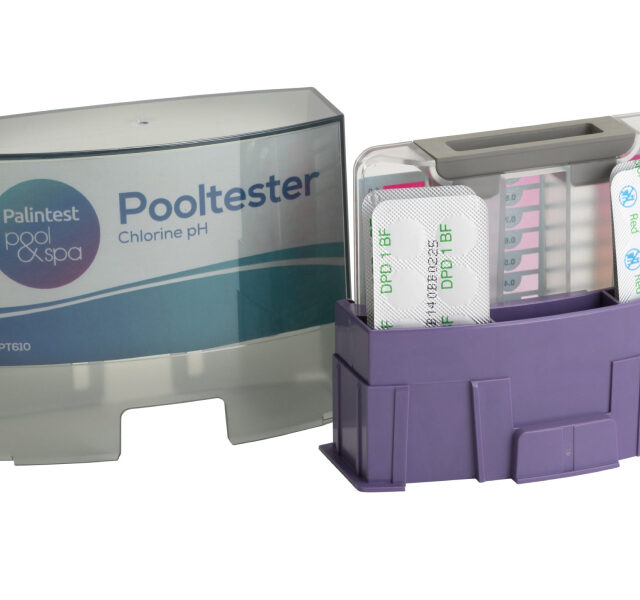
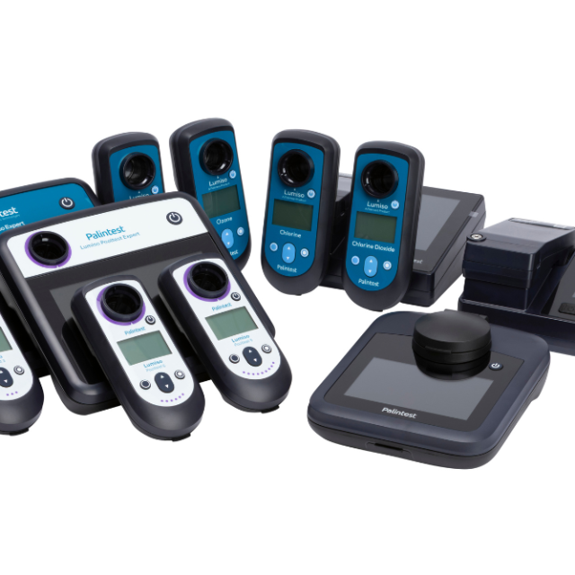
Kemio Disinfection is widely used in global development and environmental projects where field infrastructure is limited. Its combination of photometric and electrochemical testing allows for precise measurement of parameters such as ammonia, chlorine — all of which are key indicators of water safety. When paired with GPS-enabled devices, Kemio Disinfection ensures that each test result can be located and validated with confidence. Using advanced digital technology, it provides fast, reliable results unaffected by colour or turbidity, with GPS-enabled data traceability.
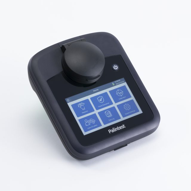
For multi-parameter chemical analysis in river and catchment monitoring, the Lumiso Expert Photometer Range offers laboratory-grade precision in a portable design. Its digital interface supports secure data logging, meaning each measurement can be linked to time, operator, and location. This is ideal for large-scale monitoring projects that depend on consistency between teams.
Finally, Turbidity Expert from Palintest adds value in sediment-heavy environments where optical readings can be unreliable. High turbidity levels can mask pollutants or interfere with nutrient testing, so accurate measurement is critical for mapping erosion and runoff events. Integrated into a geotagged monitoring system, it provides reliable baseline data for assessing changes over time.
Together, these instruments demonstrate how scientific reliability and geospatial transparency can work hand in hand. By combining Palintest’s testing technology with GPS-enabled field recording, organisations can create complete, defensible datasets that link chemistry to geography — and evidence to action.
The Future of Geospatial Water Monitoring
The power of geotagging water quality data lies not only in where we are today, but in what it makes possible. As artificial intelligence and IoT networks advance, geotagged datasets will underpin predictive models that forecast contamination events before they occur. Combined with satellite imagery, these models can reveal patterns of pollution linked to land use, rainfall, and industrial activity.
For government agencies, this evolution will mean faster response times and better-targeted enforcement. For communities, it means greater transparency — residents will be able to see real-time water quality information mapped in their local area. And for research institutions, it provides the foundation for long-term environmental datasets that can inform national and global policy.
Crucially, portable, field-ready testing will remain the backbone of this ecosystem. Laboratory results may validate data, but it’s the field instruments — the Palintest photometers, portable labs, and turbidity meters — that capture the raw, real-world readings essential to environmental truth.
Geotagging Water Quality Data
In an age where environmental accountability is under increasing scrutiny, geotagging water quality data offers a way to restore confidence in the numbers that guide our most important decisions. By embedding precise location information within every sample, we can move from fragmented datasets to unified, transparent systems that truly reflect the state of our water resources.
From India’s rural wells to urban river networks in the UK, this integration of GPS and water testing is revolutionising environmental monitoring. With reliable instruments such as the Kemio Disinfection, Lumiso Expert, and Turbidity Expert, Palintest is helping organisations around the world collect data that not only measures water quality — but maps it, verifies it, and turns it into action. Using advanced digital technology, it provides fast, reliable results unaffected by colour or turbidity, with GPS-enabled data traceability.
Frequently Asked Questions
What does geotagging water quality data involve?
Geotagging water quality data means attaching GPS coordinates and timestamps to every test result, ensuring each measurement can be traced back to its exact sampling location.
Why is geotagging important for environmental monitoring?
It enhances traceability, helps identify pollution hotspots, and supports data transparency — allowing researchers and authorities to link water quality directly to geographic context.
How do Palintest instruments support geotagging?
Palintest’s portable testing kits, including the Kemio Disinfection, Lumiso Expert, and Turbidity Expert, produce accurate, field-ready results that can be paired with GPS-enabled devices for full geospatial verification. Using advanced digital technology, it provides fast, reliable results unaffected by colour or turbidity, with GPS-enabled data traceability.
Where is geotagging water quality data used successfully?
Countries such as India, Kenya, and the UK have adopted geotagging in national monitoring programmes to improve accuracy, accountability, and environmental decision-making.
What is the future of geotagged water testing?
As IoT and AI technologies evolve, geotagged datasets will enable predictive modelling and real-time mapping, helping identify risks and drive proactive water management.
Interested? Sales@palintest.com